- Metrology Services
MEASUREMENT OF MACHINERY,
TOOLING AND INSTALLATIONSExperts in verification and commissioning
point of tools and mechanical assemblies.PRODUCT VERIFICATION
Dimensional inspection of parts
units and lotsREVERSE ENGINEERING
Digitized by scanning and
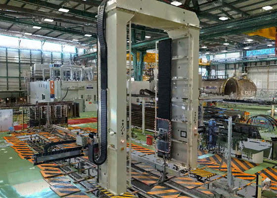
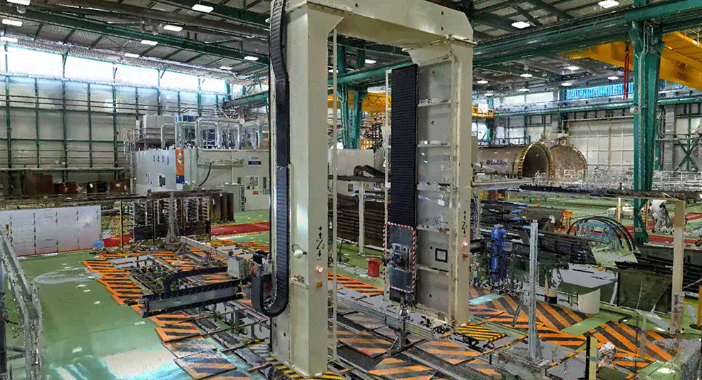
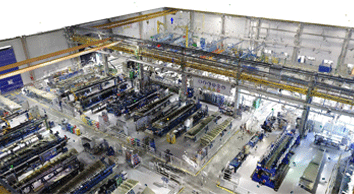
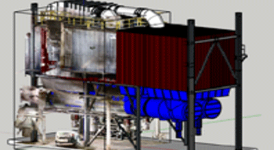
generation of 3D models.Major installations
Metrology management in large
automotive projects, aeronautics,
energy and Gics, large facilities
scientificAEC
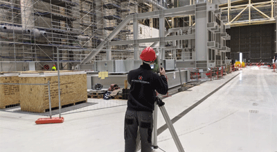
We make reality captures in
architecture, engineering and construction.
We generate digital and BIM models.Equipment rental
We have the technologies
hardware and software you need - Automations
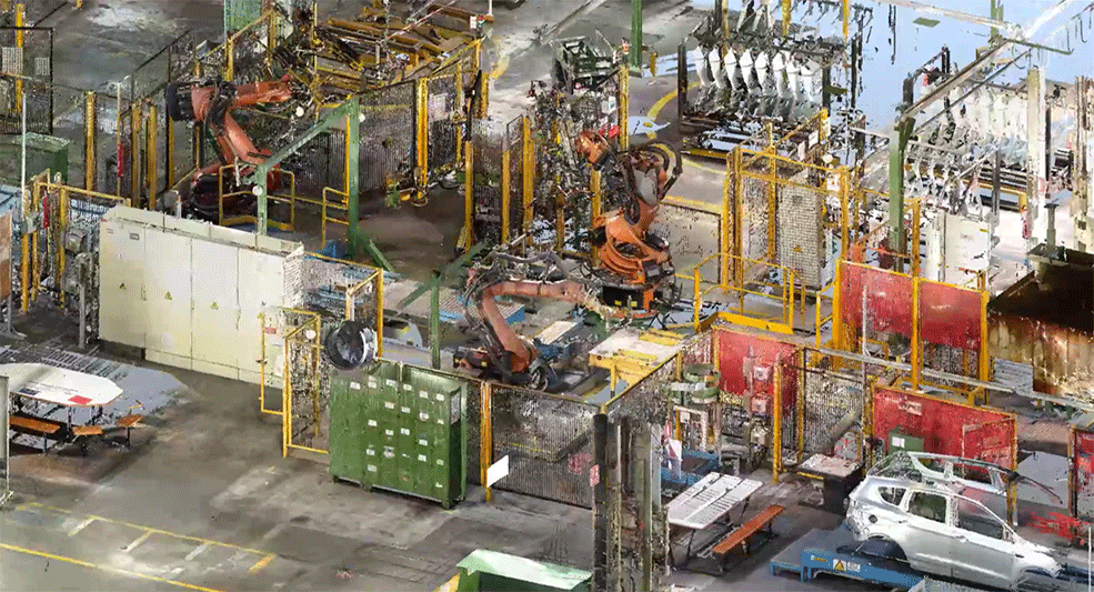
Inline automation
Te ayudamos a automatizar el control de tu
producción con un proyecto a tu medida.OFF-LINE AUTOMATION
We create inspection solutions
dimension of your production. - Product
ISI ROB
Robotic scanning station for non-contact measurement at the shop floor
SPATIAL ANALYZER
Advanced industrial metrology software for portable equipment
Faro
3D Measurement Solutions, Imaging & Realization
GAPGUN
Digital tool for manual or robotic use to control profiles.
Renishaw
Equator™ gauging system
ABB 3DMV (Metrology & Vision)
ABB Robotics | OmniVance™ 3D Quality Inspection - OmniVance™ Application cells
- Metromecánica


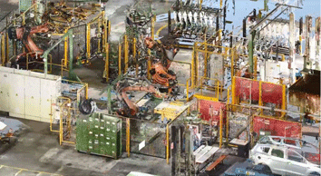
Automotive plant scanning
Aeronautical plant scanning
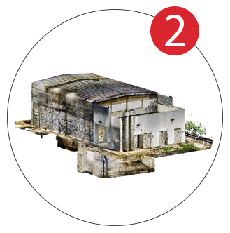
GEOMETRIC REALITY SNAPSHOT
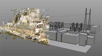
This consists of obtaining the digital model of a space from measurement technologies, photography and video 360°. The most widespread technique in industry is point cloud scanning combined with 360 images.
POINT CLOUD POST-PROCESSING
Process that aligns and joins the different scanning shots, generating a point cloud. These can be exportable to design software. They allow us to navigate, consult and take measurements.
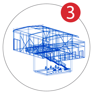
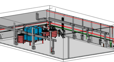
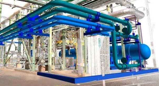
3D MODEL / DIGITAL TWIN
With the clouds it is possible to generate STL triangulated solid models, with a reverse engineering process surfaces and solid models are generated. This virtual model of the captured reality is the digital twin.
Point clouds
In standard formats compatible with CAD software (e57, xyz, las) or specific formats: Autodesk (rcp, rcs), Bentley / Siemens: pod.
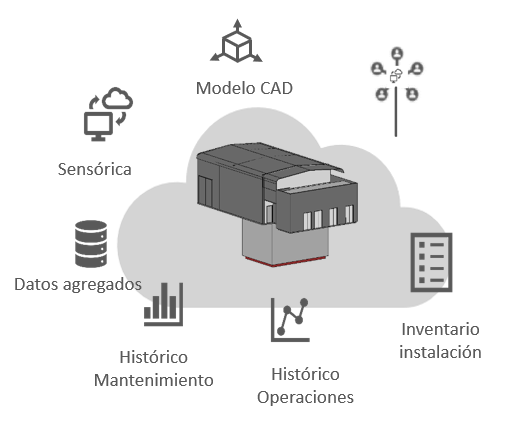
Digital twin
3D model equipped with non-geometric information to control your assets.
Virtual tours
Image and panoramic viewer. Supports VR/AR. Hyper-realistic photo quality renderings, fly thought flights.
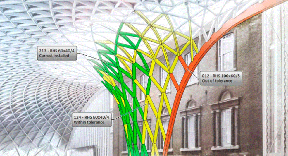
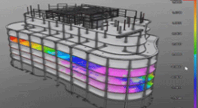
Large volume geometric verification
Deformation analysis, deviation map, manufacturing error detection.
Reverse engineering
Solid models in step or iges format. BIM as built modelling: ifc, rvt.rfa format.
Layout markings
Scanning of complete production lines for retrofitting or relocations. Creation of dwg files and marking of points in new location.
Verification and work progress
Detect geometrical deviations in pillars, walls, floors, etc. Plus analyse the status and progress of the installation.
Simulation and analysis of collisions
Allows to integrate real data capture in the 3D design and detect possible interferences.
Infrastructures
Calculation and certification of volume and dimensions. 3D comparison for deformation analysis. Documentation of current status of spaces, virtual browsing and measurement.
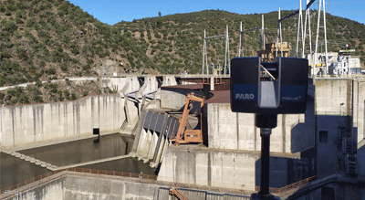
OIL & GAS Maintenance
Fast, accurate and cost-effective method to monitor geometric stability in pipeline networks. 3D comparison between scans.
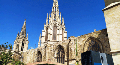
Heritage
Colour point clouds combined with high resolution digital images. 2D and 3D modelling, virtual tours with content of interest.
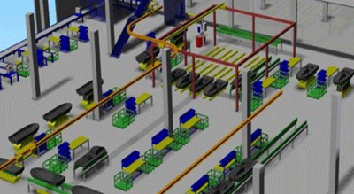
Inventory and planning
Identify your facility’s elements within the 3D model, visualize processes, workflows, stocks, layouts, etc.